


Europe at War: For a full size map click here
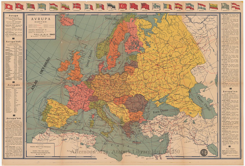
We are all used to seeing historical maps of Europe during World War Two that were drawn after the fact and therefore treat the changes wrought by the war as temporary. This map was printed in 1940, between the invasion of Poland and the invasion of France, and so it treats these changes as a fact of life. Germany is huge, Poland, Czechoslovakia, Austria and Moldova are gone, Istria and Albania are Italian, the tip of Slovakia is Hungarian and Finland has an outlet to the Arctic Sea. Historical maps of the war tend to focus on showing what was basically under German control versus what wasn't, but as Mark Mazower discusses in Hitler's Empire, the Germans actually gave some thought to redrawing borders according to their own political and nationalist logic. Ethnically German areas like the Sudetenland became part of Germany proper, while cooperative governments like Hungary's were rewarded with extra territory.
Faced with Germany on one side and Russia on the other, Turkey spent much of the war desperately trying to stay neutral. For once, the mapmakers seem delight to color all of Anatolia white, as if it was outside the mess Europe had become.