


Nick Danforth, Georgetown University
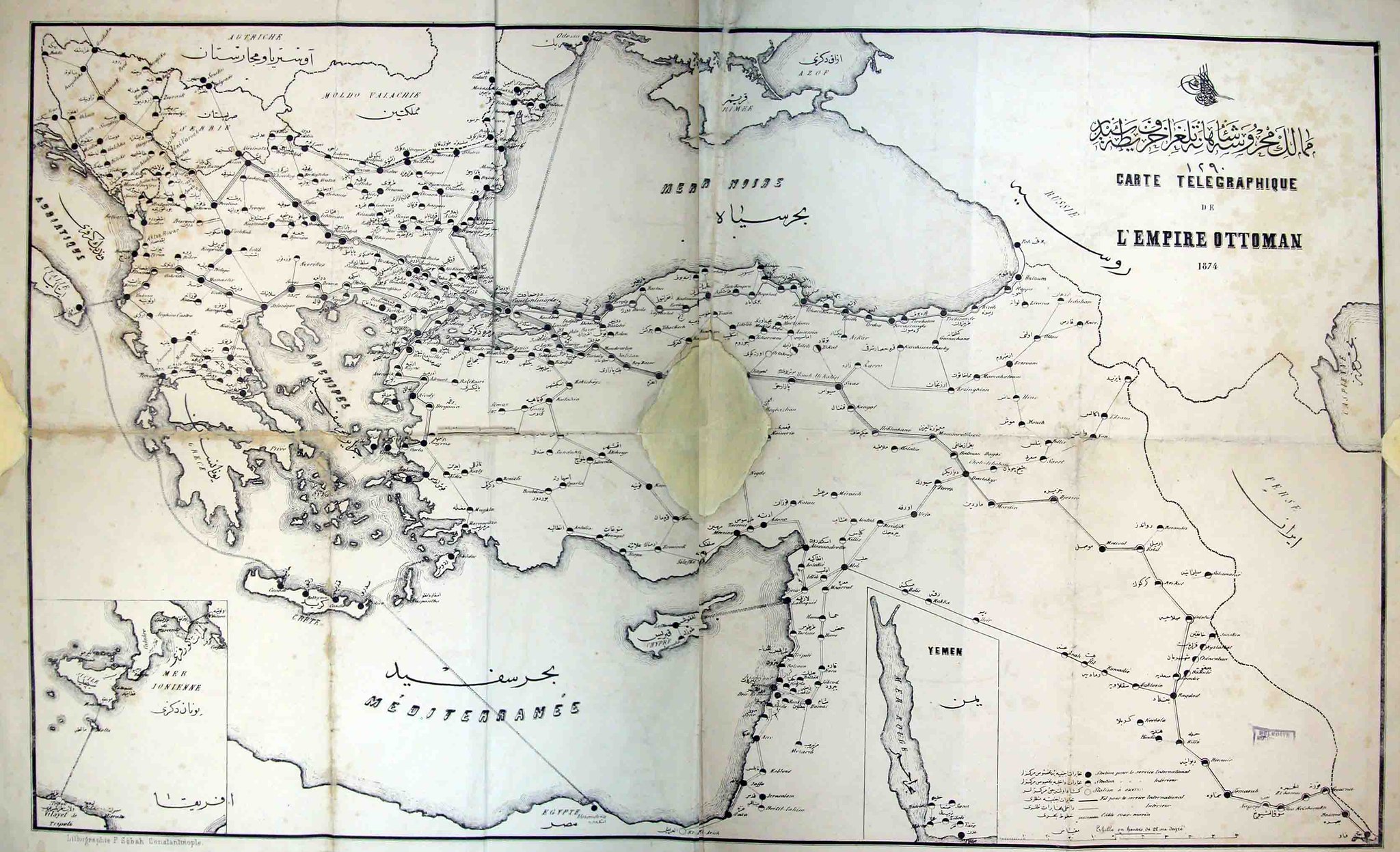
The full black dots are stations capable of international transmissions, the black and white dots are those only available for domestic use. Similarly, the thick black lines are international, the thin ones domestic. I wish I had something more profound to add here. If anyone else does please share.
Both maps are from the Ataturk Kitapligi. The first is Htr_Gec_00063. The second can be requested by its photograph numbers, DSCN5503 and DSCN5504.
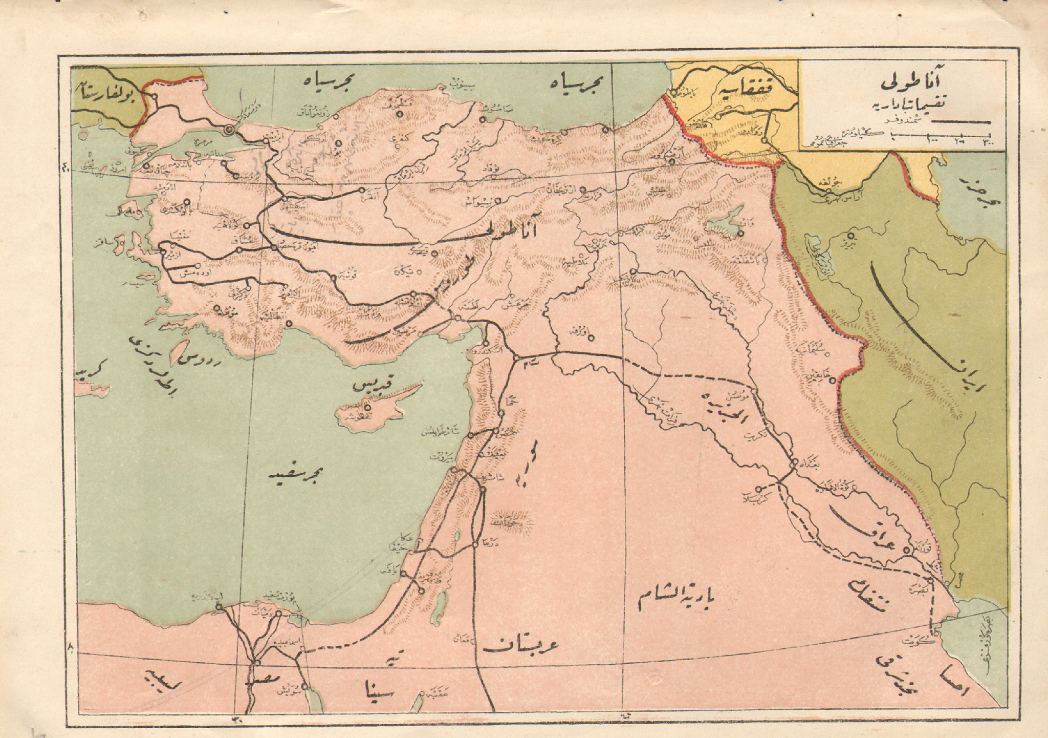
A classic map showing the Ottoman rail system on the eve of World War I, with dotted lines for the unbuilt segments. Ataturk once said that if they had finished the stretch through the Taurus mountains near Adana before the war, the outcome, at least in in their struggle with the British for control of the Middle East, might have been different. Interestingly, Benjamin Fortna points out in Imperial Classroom, Ottoman map-makers had taken to coloring Ottoman territory pink in their own maps, mimicking the color the Great Britain used for its empire. Needless to say there is no indication that Egypt is anything but an ordinary territory, and certainly not one that had been de facto independent for almost a century. It also shows Ankara at the end of the train spur going out to eastern Anatolia, which is a large part of what led to its selection as capital for the nationalist movement. Finally, the mix of old and new geographic terms is interesting. The core of what is now Iraq is labelled "Iraq," with the northern part labelled as al-Jazira, a geographical designation for the Upper Mesopotamia that has lost some currency now that the region is split between three different states. The desert to the west of Mesopotamia is the "Badiyat al-Sham" referring to the deserts and uncultivated regions of Syria, while the coastal area that includes what is now Syria, Lebanon and Israel is labelled "Syria." South of this is "Arabistan." "Egypt" is written across the Nile, with the desert beyond it described as "Libya." And Anatolia, which was once just the Western peninsular part of what is now Turkey, seems to be written so as to include everything we currently think of as being Anatolian.
It is interesting to compare the rail network to the telegraph network shown in this regrettably tattered, poor resolution and digitally cobbled together map from 1874.
The full black dots are stations capable of international transmissions, the black and white dots are those only available for domestic use. Similarly, the thick black lines are international, the thin ones domestic. I wish I had something more profound to add here. If anyone else does please share.
Both maps are from the Ataturk Kitapligi. The first is Htr_Gec_00063. The second can be requested by its photograph numbers, DSCN5503 and DSCN5504.