


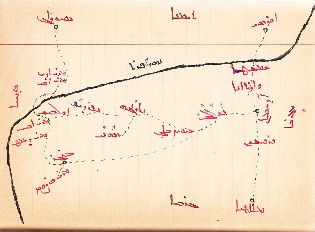
Hand drawn map of the Adiyaman region in Syriac. For a full sized image click here
One of the great things about this blog is getting emails with amazing maps like this one, from Ben Trigona-Harany. As Ben explains "The map was drawn by Bulıs Monofar, an Adıyaman-born Süryani who fled Turkey in the early 1920s for Syria, where he joined the French army and eventually settled in Homs. He was also the father of Mor Athanasius Aphrem Barsaum, the Syriac Orthodox Archbishop of Beirut. I found the map in a book - part history of the Adıyaman Süryani and part memoir - that Bulıs wrote in 1971.

A couple of passages from the accompanying text:
"At a distance of twenty seven hours is Mor Abhay monastery. On the fifteenth of July, the Adıyaman congregation makes a pilgrimage there. The road has beautiful scenery all the way to Adıyaman, with orchards, gardens, trees and flowing water. One hour from Adıyaman is a stream named Pirin which everyone to the north uses to water their gardens. Next to it there are about three thousand caves which thousands of people go to visit. Once a year in April, each guild has a day on which all its members travel to these large and small fields. There, they spend the day, from morning to evening, at the caves and by the river."
"Malatya is at a distance of eighteen hours, and between Adıyaman and Malatya, it is all mountains and forests, and every kind of wild animal can be found. There are wolves, boars, bears, dragons and other dangerous beasts. But every ten metres, one can also find sweet cold streams. And in these waters, there are countless carp. Alevi Kurds live in these mountains, and in summer it is more beautiful than Mount Lebanon."