


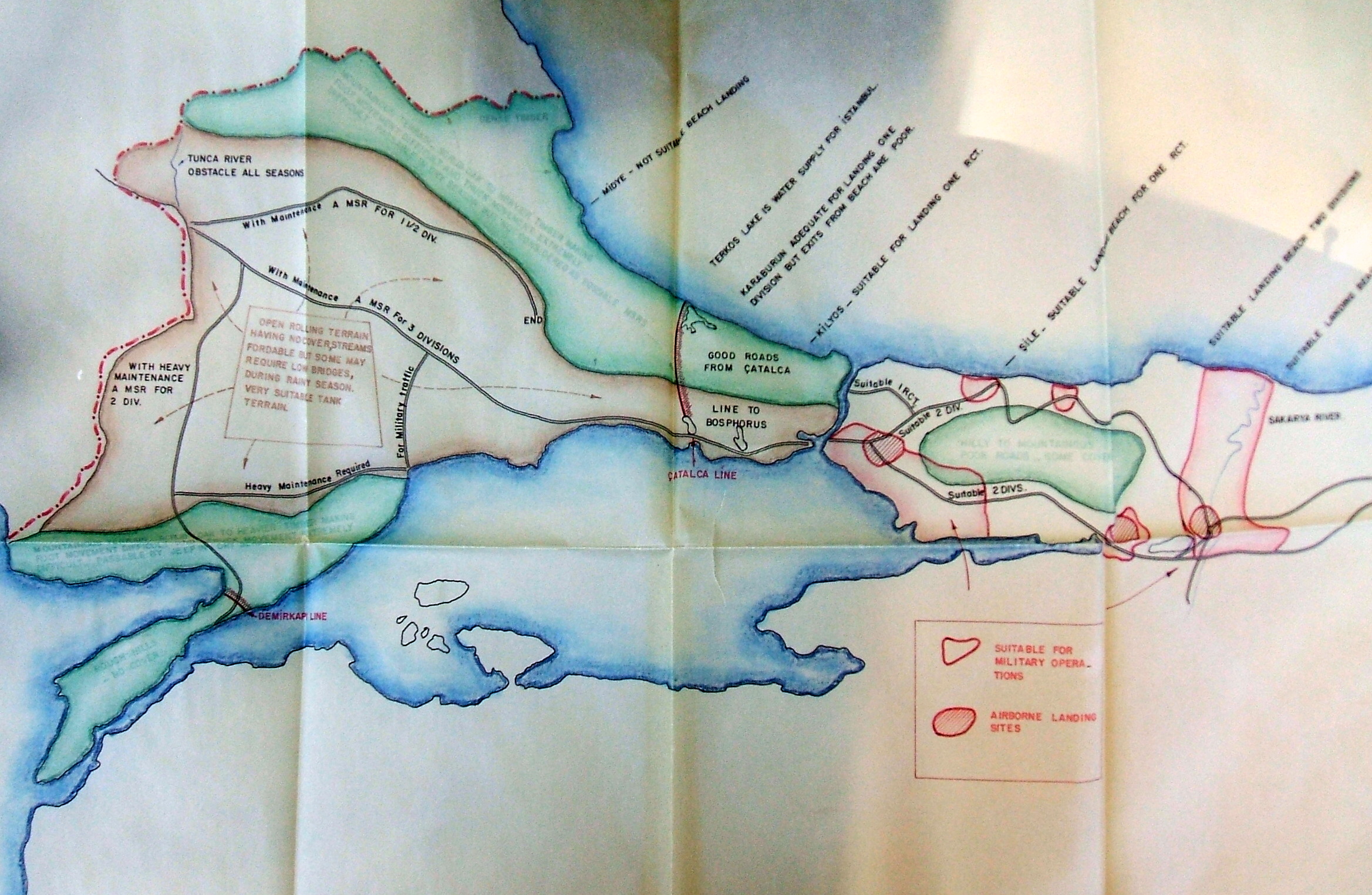
A reader was kind enough to write in the other day and provide a little more information about a conspiracy theory that this blog seems to have inspired. In January, we posted a formerly classified map (above) showing US plans for defending against a Russian invasion in the early 1950s. The post has subsequently been viewed by over 10,000 people, which, suffice it to say, is more than the average map post (and way more than the last post about Albania). Interest began when someone concluded that the proposed defensive line running accross Thrace between Buyuk Çekmece and the Black Sea was, in fact, a secret American plan for "Canal Istanbul," thus showing that the AKP's mad project had in fact been a US scheme all along. After misidentifying the Çatalca Line, one of the most famous defensive positions in Turkish military history, our ulusalcı readers went on to assume that the Demirkapı Line, at the neck of the Gallipoli penninsula, was another proposed canal. The presence of this second canal explains America's hidden goal in promoting this project: to circumvent the straights, and with them the Montreaux Convention, thereby gaining legal sanction for turning the Black Sea into an American lake.