


Nick Danforth, Georgetown University
This week is Ethnographic Map week on Afternoon Map, which is basically the map blog equivalent of shark week. We've posted some interesting European ethnographic maps of the Middle East before, but this week we have three posts with some more unusual examples of this genre. The first, today, shows the Ottomans using ethnographic maps as a tool of imperial rule in the Middle East. The second set of maps shows the Ottoman/Turkish use of ethnographic maps as propaganda to bolster territorial claims after the first world war. Finally, in the third set we try to offer a new perspective on some of the problems with this kind of cartography by showing an unusual set of ethnographic maps of my own home.

The map above is taken from the Filastin Risalesi, an official 1915 publication of the Ottoman army intended to be used as an officer’s manual for the Palestine region and discussed in some depth earlier by Zach Foster. This map was first brought it to our attention by Salim Tamari, who has published a fascinating article on it. The key reads as follows (from right to left):
Maronite - Green Diagonals
Durzi (Druze) - Red Diagonals
Yahudi (Jews) - Green Horizontals
Arab - Purple Verticals
Suriyeli (from Syria) - Red Horizontals
Rum (Greek / Ottoman Greek) - Purple Diamonds
Turk - Red Verticals
Turkmen yahut Turk (Turkmen or Turks) - Green Checks
Ismaililer (Ismaili Shiites) - Purple Checks
Mutawalli (More on this below) - Red and Green
Nusayri (More on this too) - Purple Diagonals
Durzi Koyu (Druze Village) - dotted line
Arap Koyu (Arab Village) - dotted line
There's all sorts of interesting stuff about this list, and a few things I still can't make sense of (that's where hopefully our readers will come in). The categories of Maronites, Druze, Rum and Yahudi are all pretty straightforward, and these groups are marked as being pretty much where we might expect them to be. Turks stand out mainly because of where they aren't shown, namely in Cyprus or Hatay; When subsequent conflicts arose over both these regions, the Turkish government was quick to emphasize the presence of ethnic Turks living in them. In the partial distinction between Turk and Turkmen, the map follows a relatively common-place 19th century practice of treating nomadic and sedentary peoples as separate. Like the distinction between the settled Suriyeli and the nomadic Arab, this divide would eventually disappear as Arab and Turkish nationalisms emphasized linguistic similarities over lifestyle differences. In the case of the Turkmen, this process has already begun, with the mapmakers emphasizing the group's underlying Turkishness. Suriyeli, meaning those from the region of Syria, stands out as a term I've never seen used like this before, It seemingly reflects an era after the rise of Turkish nationalism but before the rise of Arab nationalism, where the settled inhabitants of the Levant (described as Ottomans in some European maps from the 19th century) where recognized as somehow non-Turkish but still not identified with the nomadic Arabs who frequently show up on maps from the period as Bedouin. Finally, perhaps the strangest thing is the use of Nusayri and Mutawalli. Mutawallis, which today is used to refer to Shiites more generally, show up on this map as located around the city of Antakya, in an area inhabited, then and now, by people who would today be called Alawites. Nusayris, a term that today is usually used to refer to Alawites, appear both in the area between Iskenderun and Adana and south of the Maronites and Druze in the Lebanese mountains. Ismailis are nowhere to be seen. If anyone has any theories about what exactly is going on here I'd be curious to hear it (likewise, I'm at a loss for what the dotted lines showing Arab and Druze villages are all about).
In any case the fact that Ottomans were making their own ethnographic maps of the territories they ruled should be particularly exciting for that breed of Ottoman historian who loves denouncing all forms of modernization as devious European imperialist plots, then pointing out with great pride that the Ottomans were modernizing their state just like Europeans. It's what Chris Gratien once called "wanting to have your modernity and eat it too." So yes, the Ottoman state was using ethnographic maps to bolster their own imperial rule in the Middle East, at a time when ethnic demographics had come to be seen as a crucial part of the strategic terrain. The failure of this effort, a few short years after the making of this map, set the stage for the maps in our next post...
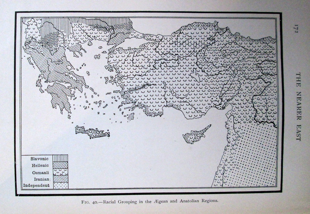
This week is Ethnographic Map week on Afternoon Map, which is basically the map blog equivalent of shark week. We've posted some interesting European ethnographic maps of the Middle East before, but this week we have three posts with some more unusual examples of this genre. The first, today, shows the Ottomans using ethnographic maps as a tool of imperial rule in the Middle East. The second set of maps shows the Ottoman/Turkish use of ethnographic maps as propaganda to bolster territorial claims after the first world war. Finally, in the third set we try to offer a new perspective on some of the problems with this kind of cartography by showing an unusual set of ethnographic maps of my own home.
The map above is taken from the Filastin Risalesi, an official 1915 publication of the Ottoman army intended to be used as an officer’s manual for the Palestine region and discussed in some depth earlier by Zach Foster. This map was first brought it to our attention by Salim Tamari, who has published a fascinating article on it. The key reads as follows (from right to left):
Maronite - Green Diagonals
Durzi (Druze) - Red Diagonals
Yahudi (Jews) - Green Horizontals
Arab - Purple Verticals
Suriyeli (from Syria) - Red Horizontals
Rum (Greek / Ottoman Greek) - Purple Diamonds
Turk - Red Verticals
Turkmen yahut Turk (Turkmen or Turks) - Green Checks
Ismaililer (Ismaili Shiites) - Purple Checks
Mutawalli (More on this below) - Red and Green
Nusayri (More on this too) - Purple Diagonals
Durzi Koyu (Druze Village) - dotted line
Arap Koyu (Arab Village) - dotted line
There's all sorts of interesting stuff about this list, and a few things I still can't make sense of (that's where hopefully our readers will come in). The categories of Maronites, Druze, Rum and Yahudi are all pretty straightforward, and these groups are marked as being pretty much where we might expect them to be. Turks stand out mainly because of where they aren't shown, namely in Cyprus or Hatay; When subsequent conflicts arose over both these regions, the Turkish government was quick to emphasize the presence of ethnic Turks living in them. In the partial distinction between Turk and Turkmen, the map follows a relatively common-place 19th century practice of treating nomadic and sedentary peoples as separate. Like the distinction between the settled Suriyeli and the nomadic Arab, this divide would eventually disappear as Arab and Turkish nationalisms emphasized linguistic similarities over lifestyle differences. In the case of the Turkmen, this process has already begun, with the mapmakers emphasizing the group's underlying Turkishness. Suriyeli, meaning those from the region of Syria, stands out as a term I've never seen used like this before, It seemingly reflects an era after the rise of Turkish nationalism but before the rise of Arab nationalism, where the settled inhabitants of the Levant (described as Ottomans in some European maps from the 19th century) where recognized as somehow non-Turkish but still not identified with the nomadic Arabs who frequently show up on maps from the period as Bedouin. Finally, perhaps the strangest thing is the use of Nusayri and Mutawalli. Mutawallis, which today is used to refer to Shiites more generally, show up on this map as located around the city of Antakya, in an area inhabited, then and now, by people who would today be called Alawites. Nusayris, a term that today is usually used to refer to Alawites, appear both in the area between Iskenderun and Adana and south of the Maronites and Druze in the Lebanese mountains. Ismailis are nowhere to be seen. If anyone has any theories about what exactly is going on here I'd be curious to hear it (likewise, I'm at a loss for what the dotted lines showing Arab and Druze villages are all about).
In any case the fact that Ottomans were making their own ethnographic maps of the territories they ruled should be particularly exciting for that breed of Ottoman historian who loves denouncing all forms of modernization as devious European imperialist plots, then pointing out with great pride that the Ottomans were modernizing their state just like Europeans. It's what Chris Gratien once called "wanting to have your modernity and eat it too." So yes, the Ottoman state was using ethnographic maps to bolster their own imperial rule in the Middle East, at a time when ethnic demographics had come to be seen as a crucial part of the strategic terrain. The failure of this effort, a few short years after the making of this map, set the stage for the maps in our next post...