View a full sized map here
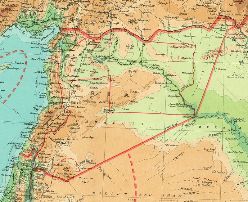
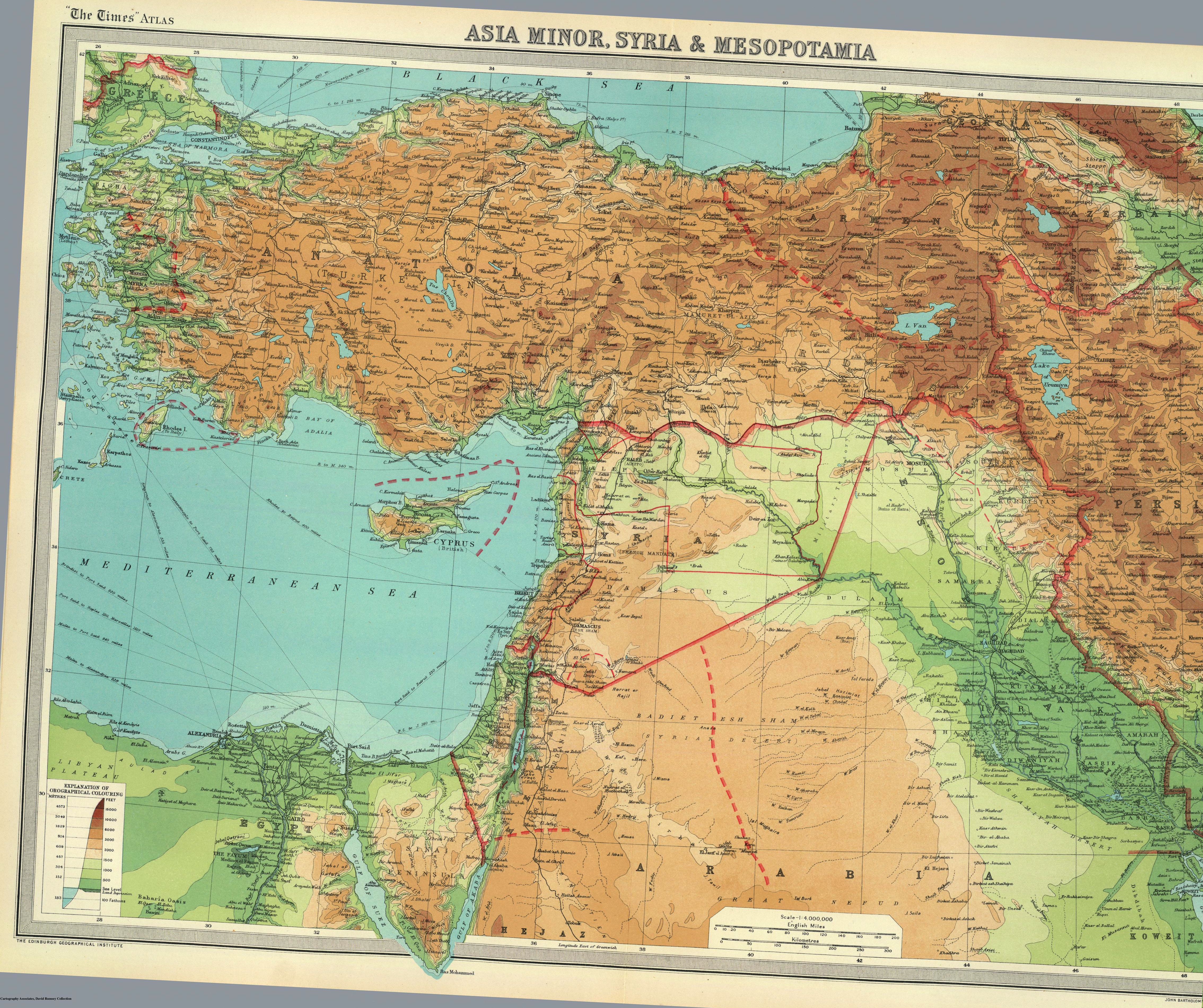
In the 568th installment of our never-ending series about Middle Eastern borders, today we have a British map from 1922, courtesy of the Rumsey Collection, showing the Middle East after its division between France and Britain but before the demarcation of its present-day states (part of Anatolia, too, is still under Greek occupation, while the borders of the proposed Armenian mandate appear in the Northeast).
As can be seen, the 1916 Sykes-Picot agreement split the Middle East into French and British controlled regions shown on this map as the undotted red line between Iraq and Syria. Subsequent subdivisions, for example between Syria and Lebanon or Jordan and Iraq were only finalized later. Ironically, while they British are often accused of creating an unworkable Iraqi state by joining together land inhabited by Shiites, Sunnis and Kurds, the French had originally proposed sub-dividing Syria into separate Alawite and Druze mini-states. (The former along the coast north of Lebanon, the latter in the south by Jordan) Faced with protests by Arab nationalists who saw it as a cynical attempt at divide and rule, the French abandoned the plan, creating modern Syria.
If anyone knows anything about the French military zone in Eastern Syria, the tentative borders of the Kurdish region in Iraq or why the border of Alexandretta are shown as an oddly small triangle please share. Or, to see more historic maps of Syria, check out Chris Gratien's collection on the subject.