


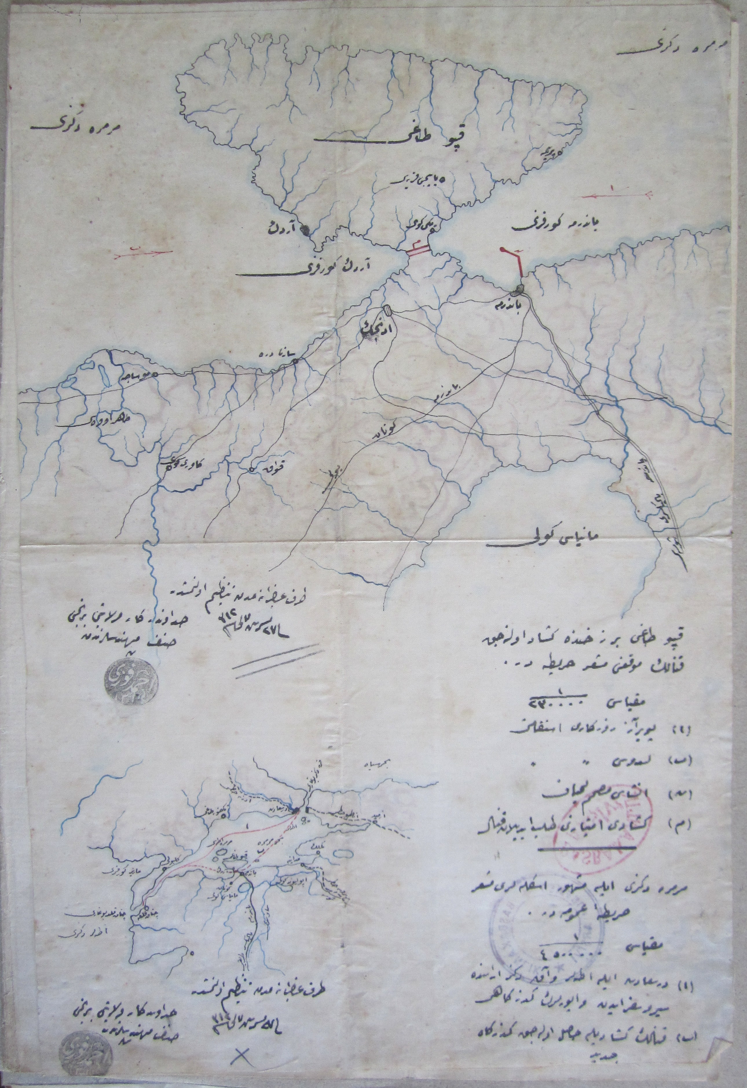
Prospective Kapıdağ Canal (Source BOA, T-TNF-VRK 44/90): for a full-sized version click here
 |
| Letter "ا" marks the route of the poyraz winds and letter "ب" marks the new route that would be enabled by the canal |
This map is from 1895 and belongs to a folder in which an engineer of the Bursa (Hüdavendigar) province named Ahmed Fevzi pitched a canal project that would reduce travel times in the Sea of Marmara by creating a canal across the thin and swampy stretch of land that connects the Kapıdağ peninsula to the mainland and the nearby port of Bandırma. The engineer stresses the commercial advantages of creating such a canal and the development it would bring to the area. The small map at the bottom (see right) shows the layout of the Marmara and the route of the poyraz (cold winds from the North) winds that give rise to storms and delay the passage of vessels.
Despite a three-page proposal stressing the myriad benefits of such a canal, there appears to have been no implementation of this plan to put the Kapıdağ Canal on the map alongside the Suez Canal and the yet to be built Panama Canal. The letter does not mention it, but during the classical period there had been some kind of canal in this location. When researching this article, I discovered that even today locals passionate about the future of Bandırma--just as this Ottoman engineer was over a century before--advocate the construction of a canal here saying "Bandırma Must Break Its Chains."
The map below shows a recent google satellite image of the area.
View Larger Map