 |
| the Federated State in soothing Green |
|
 |
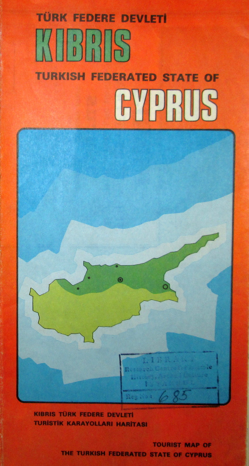
| Sort of. Another tourist map from the next decade. |
|
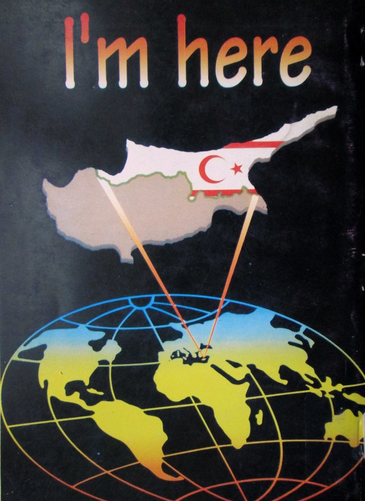
Unfortunately, the political anarchy that plagued Turkey in the late 1970s ruined one of the best chances Cyprus would have for peace in decades. Bulent Ecivet, who as prime minister in 1974 had ordered the Turkish invasion that divided the island, had the necessary stature to reach a settlement when he returned to power later in the decade, but not the political security. Until that point, Northern Cyprus had remained a federated state (still, of course, a federated state with Rauf Denktas at its head) in keeping with the official claim that the Turkish invasion was aimed at guaranteeing the constitution of 1960. After Turkey's 1980 coup, however, the North declared independence, becoming the Turkish Republic of Northern Cyprus, ending what legitimacy Turkey's actions had previously enjoyed and creating a permanent obstacle to peace. The diplomatic greens and oranges of the 1970s had become a jarring neon 1980s mess declaring "I'm Here."
 |
| Turkish by Geology |
|
 |
| Turkish by Geography |
|
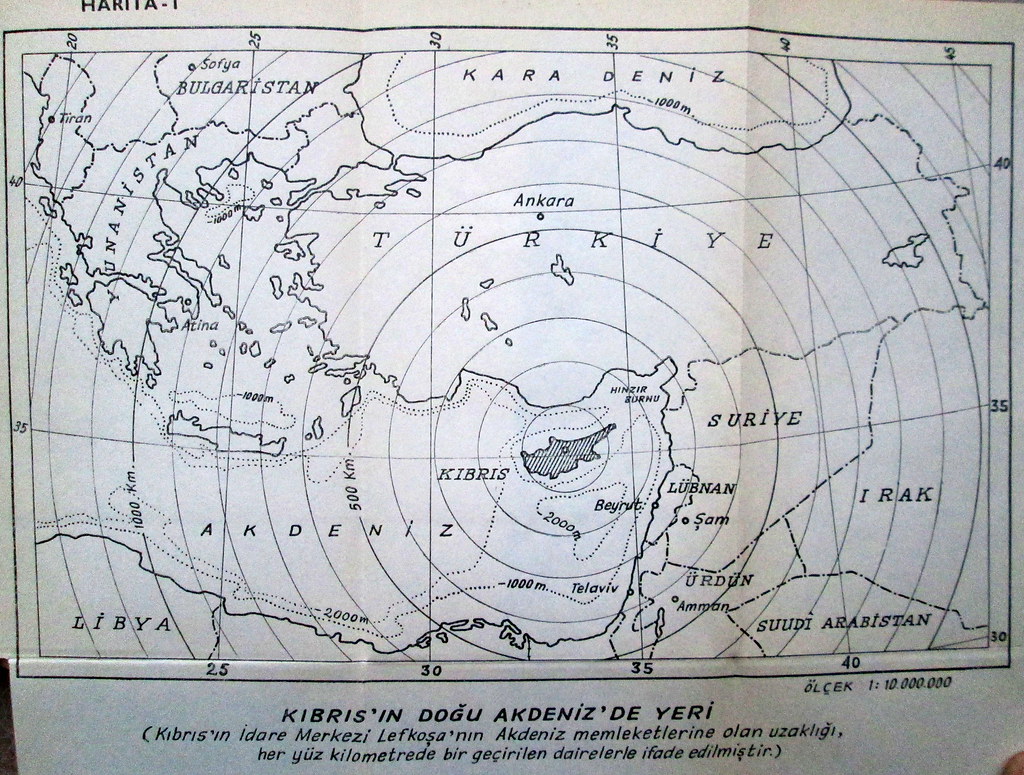
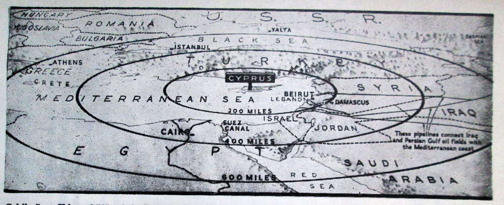
Over the years, Turkish mapmakers (Greek ones too of course, though living in Istanbul it's harder to find examples of their work) stepped in to assert Turkey's claim to at least part of the Island. Not only, they pointed out, was Cyprus geologically an extension of Anatolia, but it was certainly a lot closer to Turkey as well. If that alone wasn't enough...
 |
| By dint of Greek aggression |
|
 |
| By education |
|
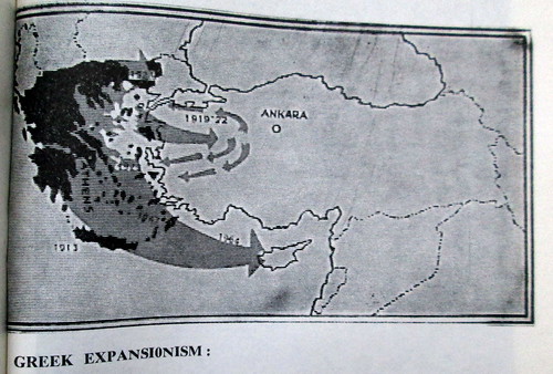
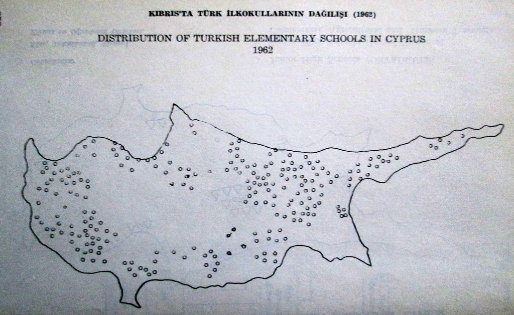
Mapmakers also pointed out that Greeks had seized Crete from Turkey in 1913, then invaded Anatolia in 1919, all in pursuit of their Megali Idea, a greater Greece at Turkish expense. Not only had Turks lived on the Island, but they had sent their children to school their too. (Black and white pictures of mutilated children remain a more common form of propaganda on both sides, more real and more disturbing than any of these maps.)
 |
| By History |
|
 |
| and Greek political perfidy |
|
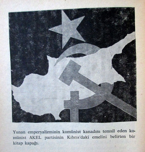
Turks had already conquered the Island fair and square during the Ottoman period, and the Greek side had an active communist party (which is still around and still open to Stalinists. Also now it's in power, at least for a little longer, and fervently pro-peace)
 |
| And by geography again |
|
 |
| All thanks to Turkey's benevolent help |
|
There has at times been tension between Turks from Turkey and Cypriot Turks. Turkey's Turks feel their Cypriot co-nationals should remain grateful for all Turkey has done for them, and resent the fact they sometimes don't. Turkish Cypriots are often frustrated by their dependence on Turkey and resent the expectation that they should be grateful for it. The map on the right, designed for a project to pipe Anatolian water to the North, captures something of why Ankara's view of the relationship might bo the Cypriots.
Finally, while its easy to criticize distorted nationalist cartography (say, the map on the left showing southern Cyprus as virtually empty) more progressive cartography has its pitfalls too. On the right is a tourist map of the Nicosia created with support of the UN. For lofty ideological reasons it doesn't show the Green Line dividing the city at all. The sentiment is admirable until you stray from the prescribed walking route and come face to face with an armed guard on your way to a historic site.
Map covers courtesy of the IRCICA Library map collection. Following maps from Milletlerarsi Birinci Kibris Tetkikleri Kongresi, 1974 (#s 1,4,6); Dunku Bugunku Kibris by Naci Kokdemir, 1957 (#s 2&7); and Belgelerle Yunan Emperiyalizmi, by Fikret Kursad et al (#s 3&5)


