Istanbul: For a full sized image click
here
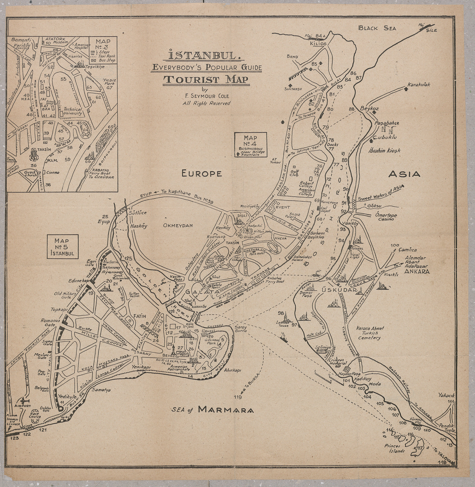
Istanbul has been a tourist destination for well over a century now, and both of these maps make it look like a nice place to visit.
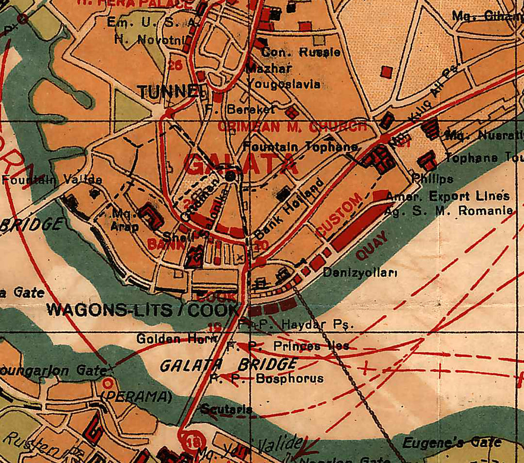
The map above, incidentally the one with a Turkish designer, displays historical features like the Byzantine chain across the Gold Horn (as well as the one stretching across the Bosphorus itself, which to my knowledge at least never existed) alongside modern features like the train station and airport. It would be tempting to conclude that this was an example of the way the tourist industry inevitably imposes a Western Orientalist viewpoint, by presenting Middle Eastern countries as indistinguishable from their pasts or forcing them to present themselves that way. But of course this historicizing is also standard in tourist maps of Western European countries and the US. The more interesting conclusion might be that “oriental” countries that have been subject to this kind of essentialization have to be careful to make sure their interest in their own history cannot be used to call their modernity into question. Here for example the map's designer has also highlighted "modern" features like the Taksim Casino, the Auto Club and the Engineering School, as if to preempt any mistaken impressions. He has also engaged in a subtle bit of essentialization himself, presenting the city’s still-active Christian churches, even those that were built in the Ottoman period or for the Armenian community, under the heading “Byzantine” monuments.
The second map does a nice job of compressing the city to show an enlarged Fatih while still including the entire Bosphorus up to the black sea. In the spot between Besiktas and Kurucesme, where one might expect to find Ortakoy, there is simply a black square labelled "
Coal Depot." If only.
Finally, there were no dates for either of these maps. The first one has the Taksim Casino, which was built in the early '40s, but not Barbaros Bulvari, built in the mid '50s. I'm sure there are real Istanbul history enthusiasts who could narrow it down even more. In trying, all I found was this story about the
Wagons-Lits/Cook company.
Source: Ataturk Kitapligi Map Collection, Hr_000822 and Hr_000041