


Nick Danforth, Georgetown University
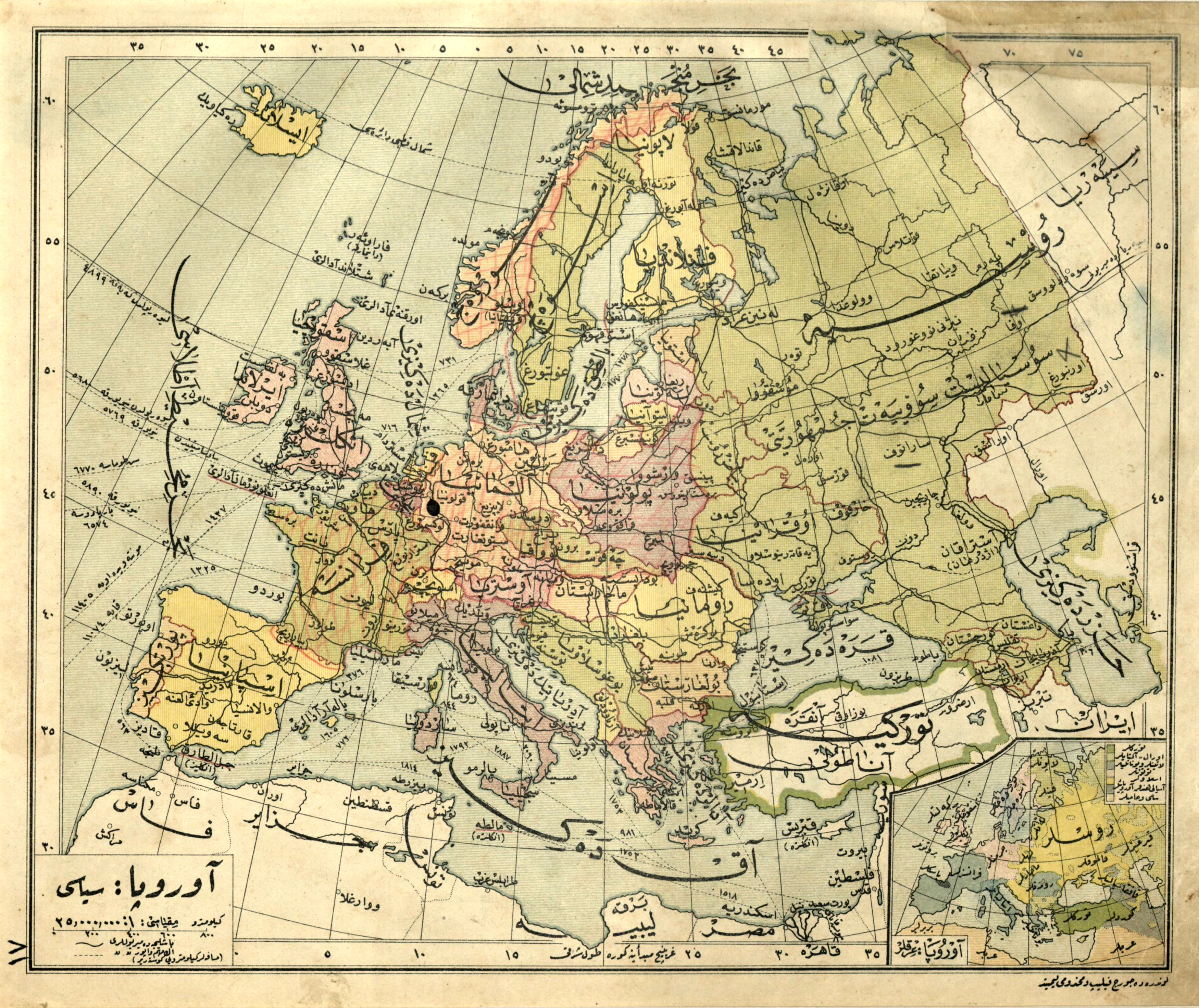
At first glance this is just another nice old map that some kid ruined with a colored pencil. A second glance, though reveals an incredible anachronism. The pink cross-hatched region corresponds perfectly to the extent of German conquests during the opening years of World War Two (maybe late 1940?). Before the advent of cheaply produced maps or the internet, people had to make their maps last, and would often update them by hand to reflect political changes. A number of Turkish maps show up with Hatay drawn in by hand after 1939, alongside those with a line sketched in between East and West Germany or offending place names vigorously crossed out. This map also serves as another reminder that Ottoman script remained widely used and understood through most of the 20th century. Through the 70s it is easy to find letters, shopping lists and margin notes jotted down in Ottoman by members of a generation that learned it first at an impressionable age. The best anecdote on the subject, quite possibly apocryphal, involves a late-night meeting during the 30s where one of Ataturk's companions was diligently taking notes in the Ottoman script. Hearing someone at the door, Ataturk turned to him and said "Quick, put that away. Ismet Pasha's coming." In any case, not knowing anything about the owner of this map, it's nice to imagine it was a precocious kid eagerly following radio news bulletins from the floor of his or her parents' living room, rather than a grown up fascist sympathizer.
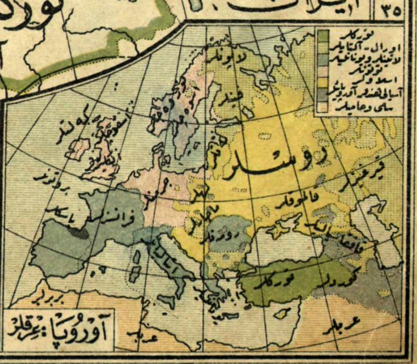 Also as a follow-up to last week's discussion of ethnographic maps, here's a little snippet from the bottom corner labelled "Races of Europe." It includes the Celts, Scots and English in Britain, Arabs and Berbers in North Africa, Kyrgyz (a term formerly used for Khazaks), Kalmuks and Caucasians in Southern Russia and as best I can make out "Lapunlar" in Lapland. The Bulgarians appear as Ural-Altaylar and the Kurds appear in southeastern Anatolia. Like many maps from the late Ottoman and Early Republican period, this was produced by the well known British mapmakers George Phillip & Sons.
At first glance this is just another nice old map that some kid ruined with a colored pencil. A second glance, though reveals an incredible anachronism. The pink cross-hatched region corresponds perfectly to the extent of German conquests during the opening years of World War Two (maybe late 1940?). Before the advent of cheaply produced maps or the internet, people had to make their maps last, and would often update them by hand to reflect political changes. A number of Turkish maps show up with Hatay drawn in by hand after 1939, alongside those with a line sketched in between East and West Germany or offending place names vigorously crossed out. This map also serves as another reminder that Ottoman script remained widely used and understood through most of the 20th century. Through the 70s it is easy to find letters, shopping lists and margin notes jotted down in Ottoman by members of a generation that learned it first at an impressionable age. The best anecdote on the subject, quite possibly apocryphal, involves a late-night meeting during the 30s where one of Ataturk's companions was diligently taking notes in the Ottoman script. Hearing someone at the door, Ataturk turned to him and said "Quick, put that away. Ismet Pasha's coming." In any case, not knowing anything about the owner of this map, it's nice to imagine it was a precocious kid eagerly following radio news bulletins from the floor of his or her parents' living room, rather than a grown up fascist sympathizer.