Tuesday, October 1, 2013

Ethnographic Maps as Propaganda


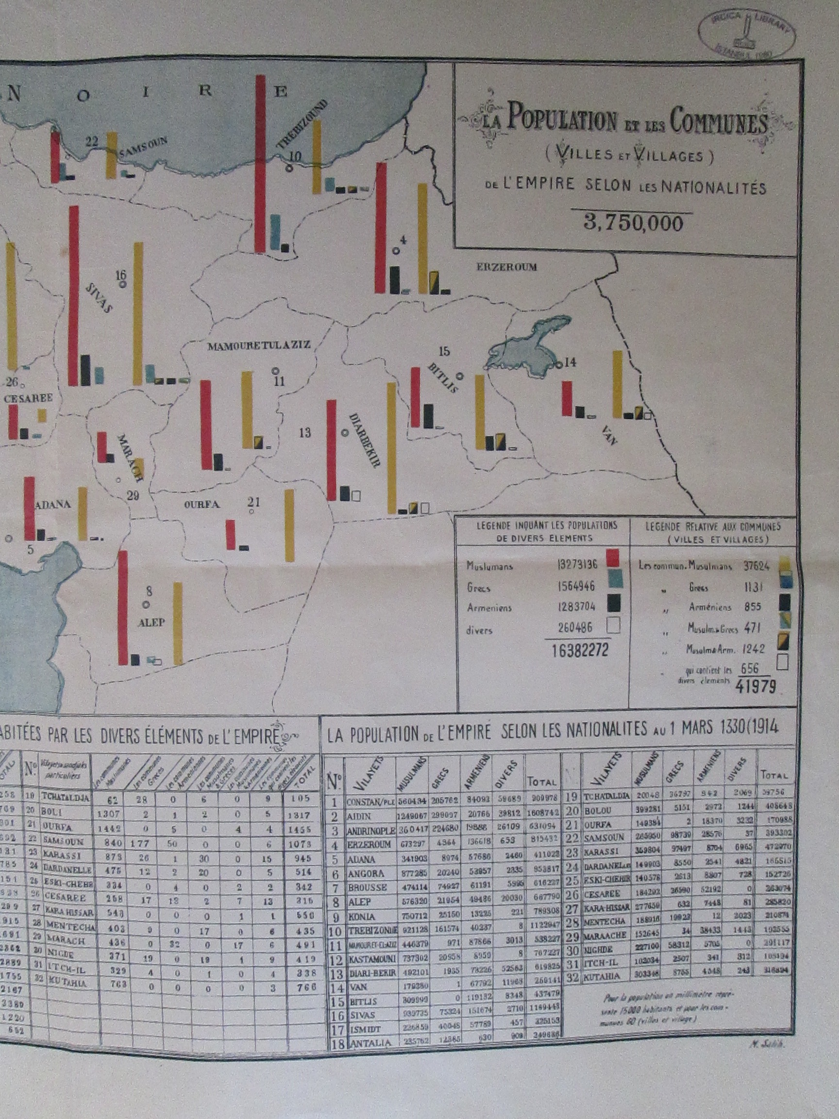
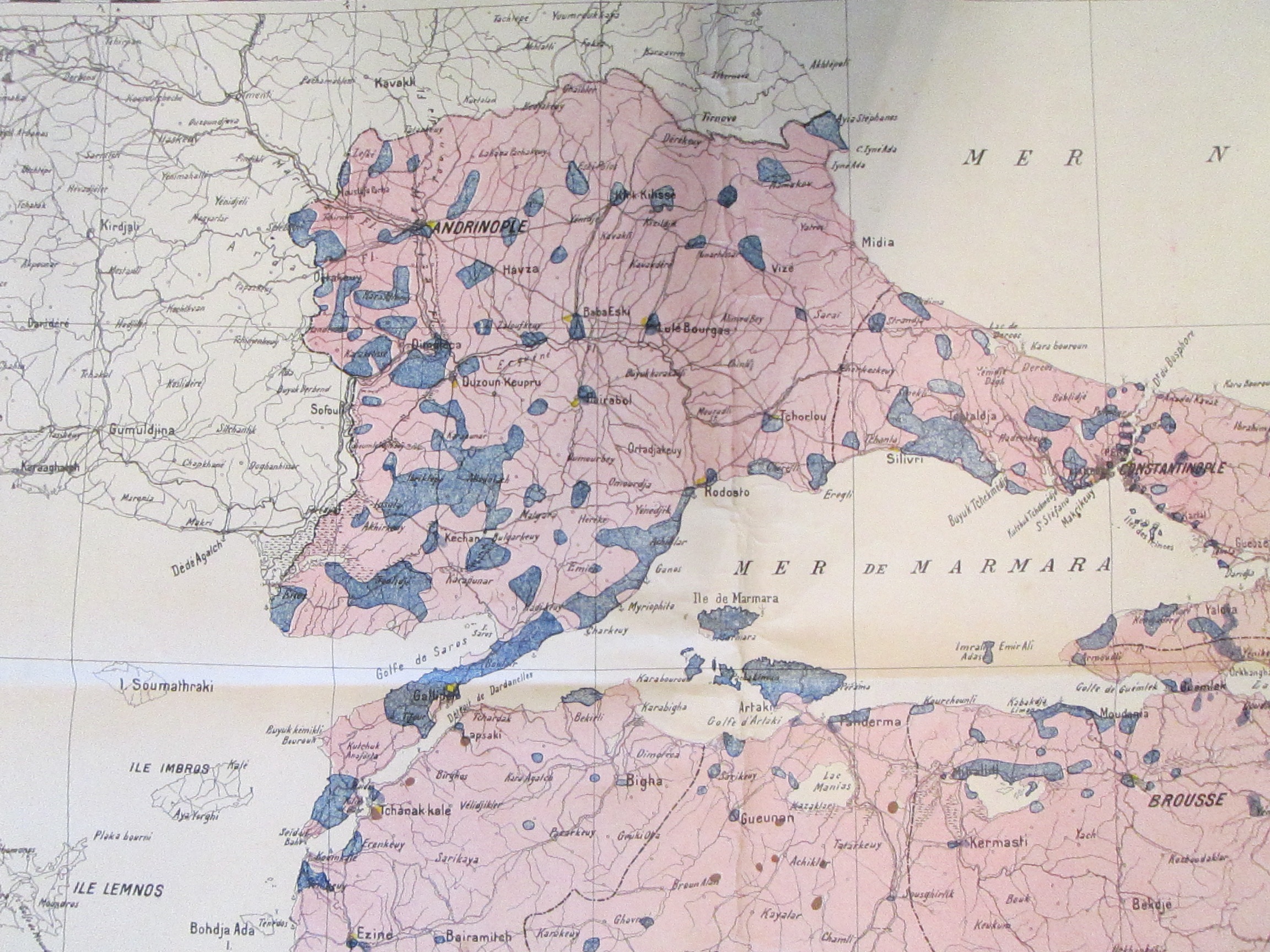
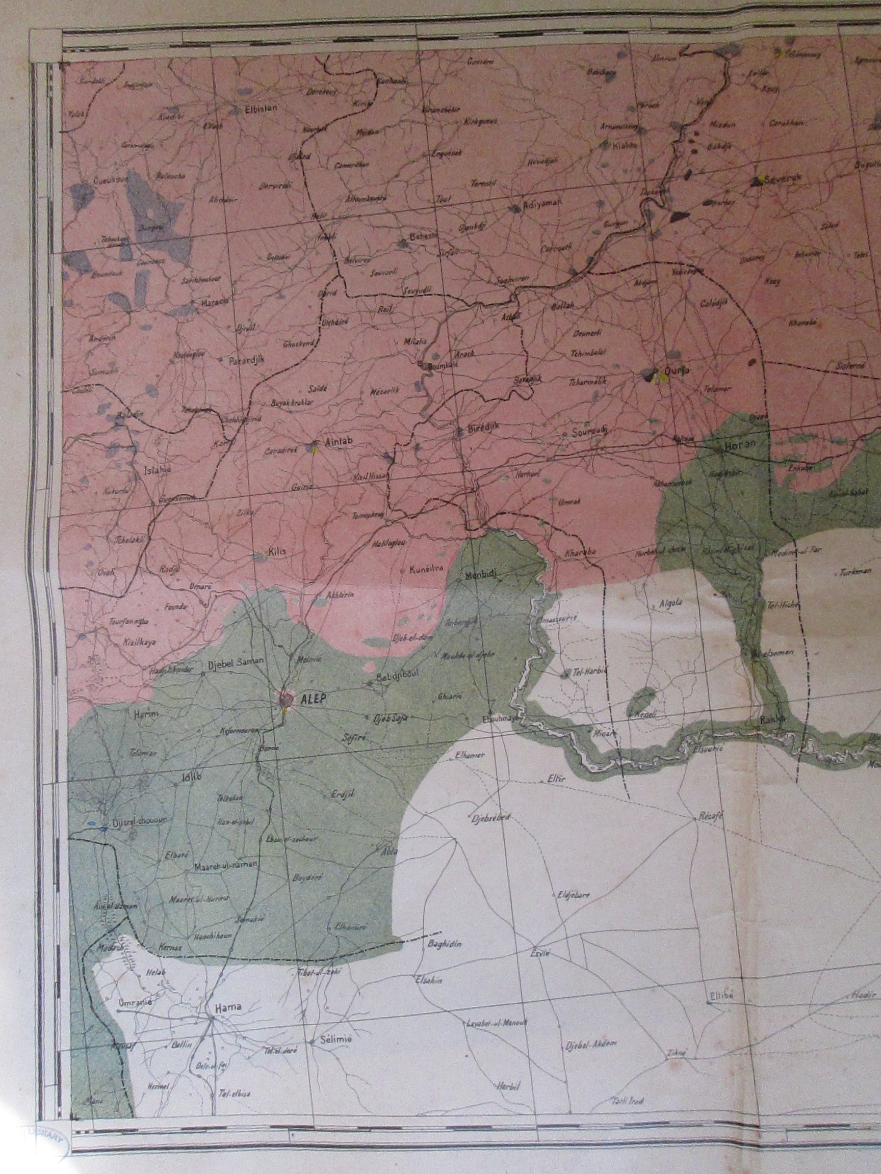
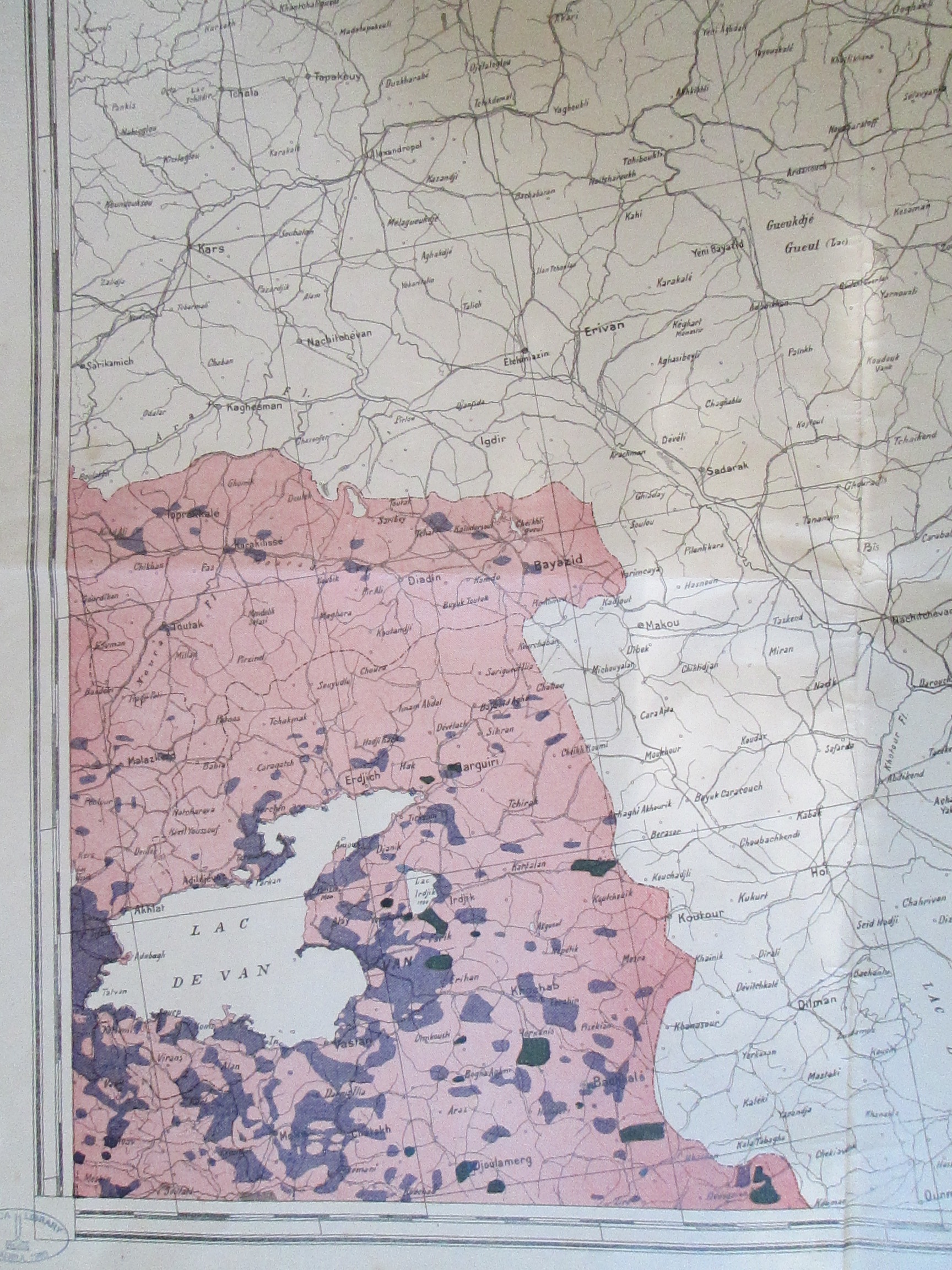
The second installment of our three-part ethnographic map week shows the creation and deployment of these maps as international propaganda in the period right after the first world war. These images come from a large set of maps made using 1917 census data purporting to show the ethnic composition of the territory that the Ottoman Empire still hoped to hold on to after World War One. While yesterday's map was written in Ottoman Turkish, this map is written in French, suggesting that it was intended for an international audience, suitable to serve as a visual aid at a European peace conference. (If anyone knows more about M. Salih, who made this particular set of maps, I'd be curious to know. They appeared in the IRCICA library, which has an amazing maps but little information about the source of their collection). Woodrow Wilson's emphasis on national self-determination gave many people - members of ethnic minorities but also in many cases leaders of non-Western states like Turkey - hope that any post-war settlement would recognize their political and territorial aspirations. These hopes were based both on an optimistic assessment of the role Wilson's Fourteen Points would play in peace negotiations as well as generally optimistic demographic readings of the region inhabited by members of a particular nation. In this context, the production of maps like these were part of the rhetorical arsenal of every state and minority group aspiring to statehood in the immediate post-war era. Thus included in these sets of maps are the regions around Aleppo/Halep and Mosul, showing the supposed ethnographic basis of Ottoman territorial claims at the end of the war.


Among other things that stand out is the categories into which the mapmakers have chosen to divide people. Christians were divided up into as many confessional groups as possible, in contrast to the new national identity emerging among some of these populations themselves. Yet while the map identifies Arabs as a distinct ethnic group, the dominant population appears as "Elements musulmans (hors l'element arabe)" or Muslim Elements (except for Arabs). This cleverly allows the map to combine Kurds and Turks into a single majority without quite having to claim the Kurds were Turks. There is also, seen most clearly in the maps below, an  attempt to minimize the amount of territory shown as non-Turkish. Using a trick well-established among makers of these sorts of maps, the cartographer has shown predominantly Greek cities and towns as blue but colored the sparsely inhabited territory between towns pink by default. Greek communities were more frequently urban-dwelling but not to anywhere near the extent shown by this map, which seems to suggest that the soil itself was Turkish/Muslim. This is even more striking in the maps of Eastern Anatolia, where territory was assumed to be Muslim in the absence of a clear Christian population. 


Below, another set of maps by M. Salih from the same time:


These offer another presentation of Anatolia's seemingly overwhelming Muslim majority, complete with detailed statistical tables. What stands out about these, apparently made with 1914 census data instead of 1917 data, is that in addition to again dividing the terms in the state's favor (Muslims versus the ethnically divided Armenians and Greeks) they also provide a breakdown by village, the vast majority of which have been identified as either Muslim or mixed Muslim and Christian.