


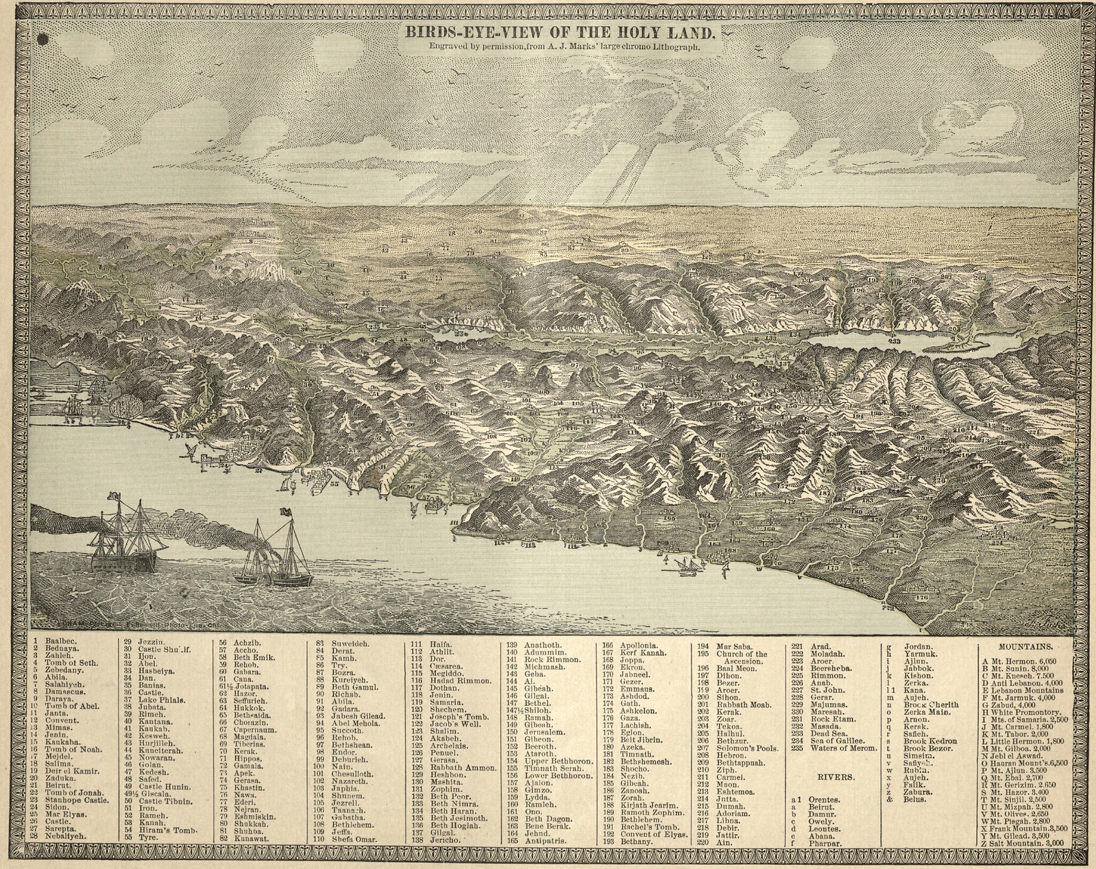
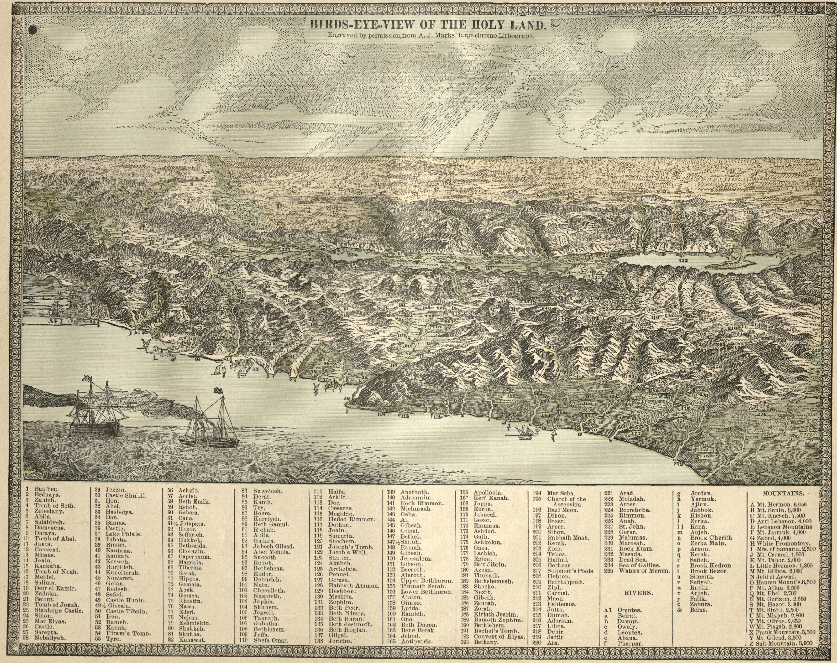
A Birds Eye View of the Holy Land, from Beirut to Gaza, taken out of a turn of the century US atlas. I actually thought this was a handy reference for understanding the geography of the region today as well. For the full sized image, complete with the little Ottoman flags on the boats, click here. And here's a map of paradise from around the same time.