


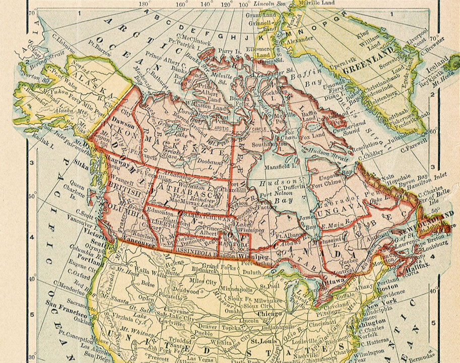
In today's post we return to the always vexed question of Canadian borders and explore how the contemporary map of Canada took shape. Do the country's unremarkable borders, imposed by British imperialists a century ago, explain the unremarkable depths into which it subsequently plunged? Did the Durham - Sydenham Union Act sow the seeds of the region's present-day boringness? What if the map of Canada contained 14 provinces instead of however many provinces it actually has? And could the presence of an independent Athabasca have prevented the tensions that subsequently consumed mini-Manitoba? What if Keewatin and Ungava still maintained their sovereignty in the face of Quebecoise and Ontarian irredentism? Today's map forces us to consider the slightly more interesting country Canada could have been and ask "was a different future possible for our northern neighbor?"
For some genuinely interesting history about Canada's western provinces, check out this Canadian Geographic article.