Monday, December 30, 2013

Mokomokai: The Baked Maori Head Trade


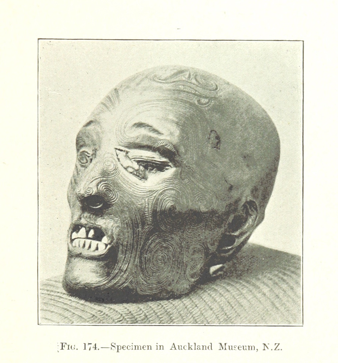
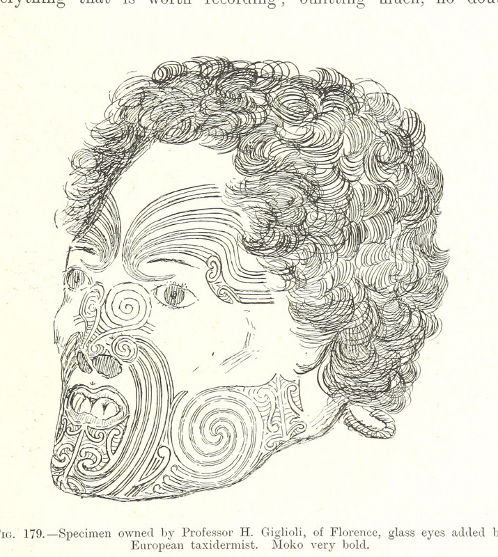
Sometimes, as with the Royal Asiatic Reader, this blog travels to other regions in search of stories that explain or dramatize aspects of colonialism also important for the Middle East. Today this brings us to the subject of Mokomakai, the preserved heads of dead Maori that were traded extensively by Englishmen in the early 19th century. (You can read in more depth about the Mokomakai trade in Major-General Robley's 1896 work on the topic, from which the photo at left is taken, or in this more recent summary)

In short, Maori had long dried and preserved the heads of dead relatives, for veneration, and enemies, on occasion, as trophies of war. Arriving in the late 18th century, English sailors began purchasing the heads as curios, then selling them to ethnographers, naturalists and collectors back in England. In order to meet European demand, traders began buying up more and more heads, often in return for the muskets that Maori needed to fight increasingly vicious local wars. Tribes with muskets used them to defeat rival tribes, whose heads they then sold, while tribes without muskets sought to acquire heads that they could trade for much needed arms to defend themselves. The result was that while the elaborate facial tattoos prized by head collectors had once been reserved for social elites, Maori began tattooing their slaves before killing them so their heads would fetch higher prices. European buyers were reported to have even selected future specimens from among still-living slaves.
In the 1830s the British Governor General in Australia officially banned the practice, but by then it largely died out - the Maori market was saturated with muskets and the European market was saturated with heads. As in so many cases, colonialism had introduced new technologies and market pressures that radically transformed local societies, in this case with particularly brutal results. Beyond this, though, the example of Mokomokai seems to exemplify one of the most provocative but often hardest to articulate arguments found in Orientalism: that the power dynamic between colonized and colonizer was such that European perceptions of Oriental subjects had a self-fulfilling quality, often becoming reality without either party fully realizing it. In this example, Europeans misinterpreted particular Maori embalming practices, seeing them as an example of widespread primitive savagery. Their  semi-scientific fascination with these practices, coupled with their wealth and military technology, created the circumstances in which this previously restricted practice truly became something widespread and barbaric. All without the heads' wealthy European purchasers realizing that they were responsible for much of the savagery they believed that they were simply documenting (and then took credit for suppressing)
Wednesday, December 25, 2013

Arabs through Turkish eyes


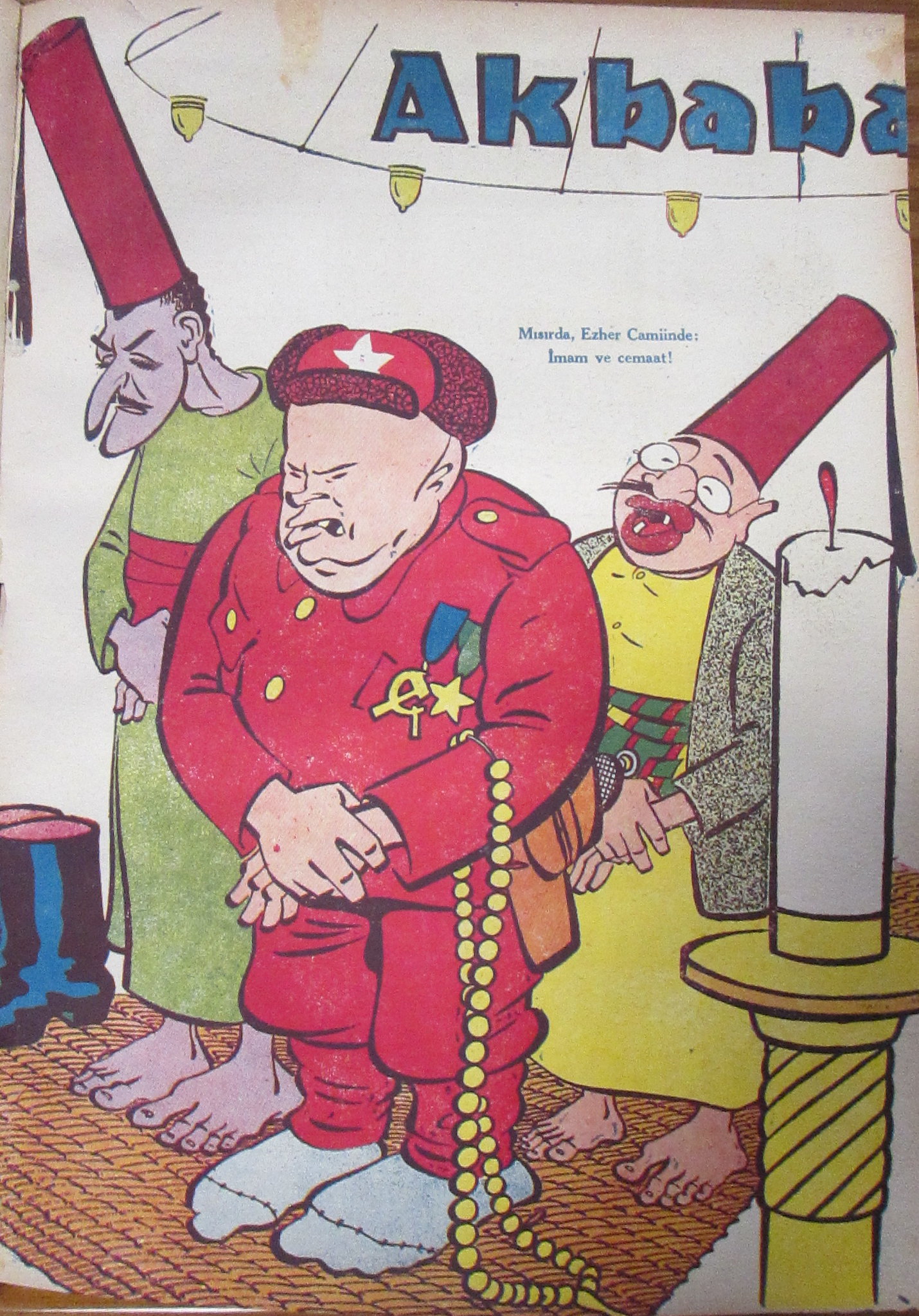
We are posting an article version of this week's Ottoman History Podcast about Turkish prejudices and policies toward the Arab world during the 1940s and 50s. The PDF, which has a number of images not appearing in the podcast, can be downloaded here (because of the size - 47 megabytes - a few extra clicks are required). A version of this article was originally intended for publication in Jadaliyya, but was ultimately declined out of concern that some of the images could be "taken out of context and used to attack" the magazine. On that note, please do not take these images out of context and use them to attack Afternoon Map. I strongly believe that, viewed in context, they are a necessary part of any honest discussion of Middle East history and politics.

Wednesday, December 18, 2013

A Very Hoja Christmas

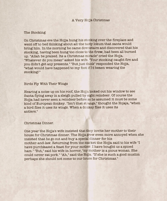
 If ever there was a conflict that epitomized the  divide between West and East, it is surely the longstanding rivalry between Santa Claus and Nasreddin Hoja. The respective merits of these two fat, jolly, bearded men have been the subject of countless cartoons and, well, more cartoons. Today, in the spirit of both the season and prevailing historiographical trends, we're pleased to feature an interpretation of this relationship emphasizing collaboration and co-mingling rather than conflict. It perhaps only fitting in light of the text's  syncretic nature that I can't say anything about the author's background - it turned up folded inside a collection of Nasreddin Hoja stories written in English, for sale in Turkey.


Sunday, December 15, 2013

Three Maps of Asia

For a full sized image click here

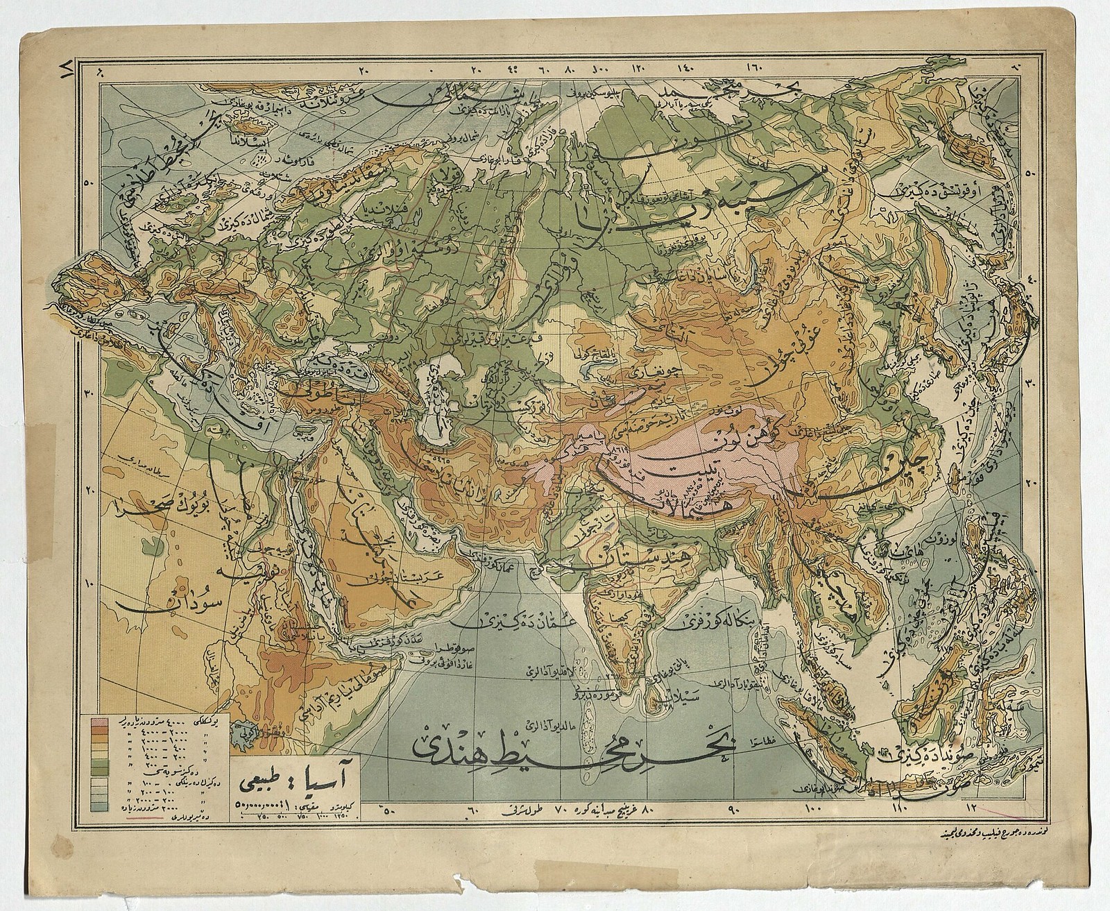
Today, three maps of Asia. First, a late Ottoman physical map of the continent made by George Philip and Sons. Not much to say besides this might be one of the nicest looking maps ever made. I mean check out the close up to the left, or the shade of pink used for Tibet. It's impressive too that in spots like Siberia the map's makers have managed to have place names intersect without any loss of legibility.

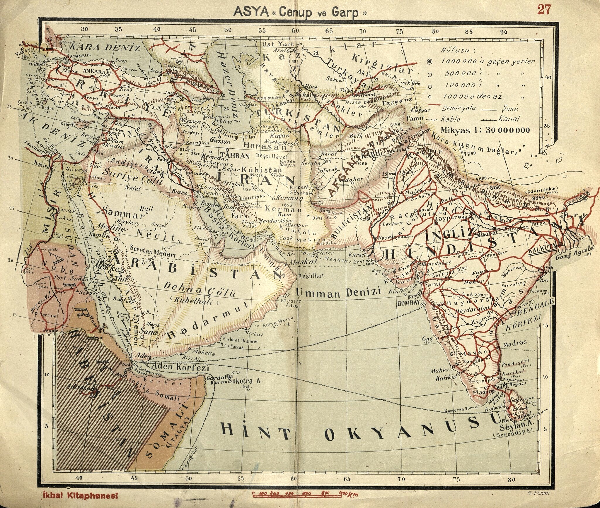
Second, a map of southwest Asia from an inter-war atlas bringing together some themes from earlier maps: Turkey's train network (almost on par with India's), the Hijaz Railway, Iran's complete lack of trains (an impediment to transporting opium), and the Soviet national delimitation in Central Asia (here the mapmakers seem to have included the new nations as ethnic groups and kept the old Czarist political label of Turkistan). There's something strange going on with the Turkish Iraqi border too, that will hopefully be the subject of a future post. Though at this point in time Istanbul's printing houses clearly didn't have the ability to achieve quite the same visual elegance as British printers, relatively cheap maps like this managed to reach wider audiences and offer a perspective on the wider world to a new, increasingly literate generation.


And finally, a very early Republican map of Asia with some analysis by Chris Gratien.
Late Ottoman Map of Asia: for a full size version click here.

"This map of Asia, from the education ministry's miscellaneous papers, shows the way the Ottoman interest in Asian geography may have become problematic for the new Republican Government. An inscription at the bottom says this map was available for sale in Fatih on Kasaplar Street in İranlı Mehmed Ağa's shop across from the police station. While the map bears no date, it was found in two copies within a folder labeled circa 1339 (1920/1921) and in a box full of documents issued by the Grand National Assembly of Turkey during this period of transition. Turkey was not officially recognized as a sovereign state until 1923, but by 1920 the Ankara-based government was already removing Ottoman institutions and symbols to create a new government.

"The map is a geographic one more than political, although some political boundaries are traced, rather befitting of a time in which the boundaries of empires and nations were shifting. The borders of Asia itself conform to the conventional European definitions of the time: the Caucasus and the Urals, so most of Russia is labeled as Europe and therefore receives no detail. In fact, no reference to the Russian state appears in Asia on this map. The Ottoman domains are labeled as Ottoman Asia (Asya-yı Osmani). While administratively the Empire was not divided this way, it conforms to the way Europeans conventionally divided the empire with concepts such as Turquie d'Asie. This geographic issue may have been less of a problem when the Ottoman state was still an empire with territories in Europe seeking to be part of the European state system, but the question of Asia's limits might have given more pause in republican Turkey given that only a very small piece of the nation-state remained in conventionally defined Europe."

BOA, MF-VRK 50/39 (1339)

Monday, December 9, 2013

Predicted Casualties from an Istanbul Earthquake


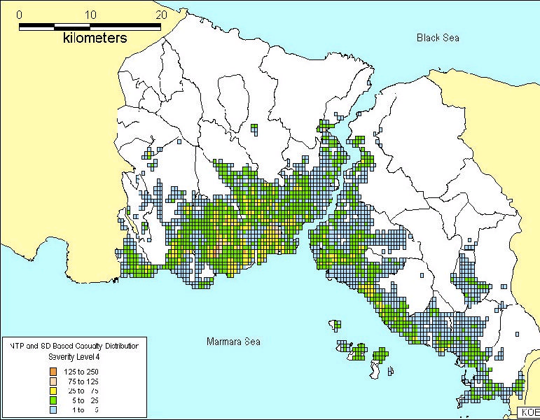
Predicted casualties in a 7.5 magnitude night-time earthquake, from  Mustafa Erdik's Earthquake Vulnerability of Buildings and a Mitigation Strategy

Istanbul, where our blog was started, is a city uniquely vulnerable to earthquakes. Earthquakes, like many other disasters, kill along class lines. People in poorly built houses die while people in well built houses live. Particularly troubling, I think, is that almost all the research about how to keep safe in an earthquake has been done for people living in the kinds of places - California, Japan - where they can reasonably expect that their houses won't collapse. For a long time now people in Turkey have been told about the "triangle of life," a survival strategy that involves sheltering next to large, incompressible objects like beds and was developed by one of the first responders to the Kocaeli quake. When this recommendation started making the rounds a number of prominent earthquake experts reacted angrily, warning people that it was a completely unreliable and untested strategy. The problem, though, as some experts acknowledged, was that no one really has any better advice for what to do when you live in an unreliable building, where even the standard recommendation - always stay indoors - might not hold true.

Sunday, December 1, 2013

Ya Gokteki Babamiz


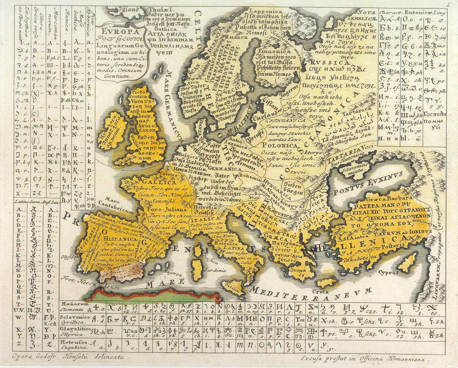
Today's map was drawn in 1730 by someone named Gottfried Hensel, and features the opening of the Lord's Prayer written in all the languages and scripts used throughout Europe (for more check out the entry at Strange Maps). Particularly interesting - aside from the utter incomprehensibility of the version of old english the mapmakers chose to use - is the Ottoman and Tatar renderings of the prayer. As seen below, both are written out in Arabic script using all capital letters, and the Tatar has a questionable transliteration under it. The Ottoman seems to read "Bizim Atamız ki Göktesin" and the Tatar "Ya Babimiz ki yüksek Göktesin." It's not clear where the mapmaker got these translations, although the language isn't that different from several versions of the prayer in modern Turkish. Below are translations in two different registers of Turkish, one which borrows more heavily from Arabic religious terminology. Finally, Google Translate's attempt, impressive at moments and somewhat silly at others.


"Göklerdeki Babamız, adın kutsal kılınsın. Egemenliğin gelsin. Gökte olduğu gibi, yeryüzünde de senin istediğin olsun. Bugün bize gündelik ekmeğimizi ver. Bize karşı suç işleyenleri bağışladığımız gibi,sen de bizim suçlarımızı bağışla. Ayartılmamıza izin verme. Kötü olandan bizi kurtar. Çünkü egemenlik, güç ve yücelik sonsuzlara dek senindir. Amin." (marypages.com)

"Ey göklerde olan Babamız, İsmin mukaddes olsun; Melekûtun gelsin; Gökte olduğu gibi yerde de senin iraden olsun; Gündelik ekmeğimizi bize bugün ver; Ve bize borçlu olanlara bağışladığımız gibi, bizim borçlarımızı bize bağışla; Ve bizi iğvaya götürme, fakat bizi şerirden kurtar; Çünkü melekût ve kudret ve izzet ebedlere kadar senindir. Amin." (prayer.su)

"Cennetteki Babamız, adın kutsal kılınsın. Sizin krallik gel, cennette olduğu gibi dünyada da, sizin yapılacaktır. Bize karşı suç işleyenleri bağışladığımız gibi, bizim suçlarımızı bağışla ve bize bu gün bize gündelik ekmeğimizi ver . Günaha bizi değil kurşun ve kötü olandan bizi kurtar. Sizin için güç ve krallık ve zafer olduğunu." (translate.google.com)

Monday, November 25, 2013

Where the Bull Begins: Lawrence Durrell in the Mediterranean


Before Louis de Bernieres, Lawrence Durrell was the British guy who wrote books people read about the Eastern Mediterranean. His work, as the map shows, covers a large swath of former Ottoman world, including travel writing about the Greek Islands, self-indulgent orientalist fiction set in cosmopolitan Alexandria and adventure stories for young adults set among Tito's partisans. As a tribute to Durrell we offer this map of places Durrell has written about, as well as a few of his more memorable quotes:
From the opening of Prospero's Cell, a travel book about a year on the Greek Island of Corfu:  "Somewhere between Calabria and Corfu the blue really begins..."

And later “Other countries may offer you discoveries in manners or lore or landscape; Greece offers you something harder – the discovery of yourself."

In Justine, the first book in the Alexandria Quartet, Durrell describes the eponymous city: "Capitally, what is this city of ours? What is resumed in the word Alexandria? In a flash my mind's eye shows me a thousand dust-tormented streets. Flies and beggars own it today - and those who enjoy and intermediate existence between either. Five races, five languages, a dozen creeds: five fleets turning through their greasy reflections behind the harbour bar. But there are more than five sexes and only demotic Greek seems to distinguish among them... Alexandria was the great winepress of love; those who emerged from it were the sick men, the solitaries, the prophets - I mean all those who have been deeply wounded in their sex..."

In Mountolive, the third book in the quartet, Durrell narrates a love affair between a young British officer and the older Egyptian woman from whom he is learning Arabic. It might be the paradigmatic orientalist romance narrative:

"Mountolive... had obtained permission to stay for two months in the house of this Coptic squire. It was a complete departure from everything he had known to be thus included in the pattern of a family life based in and nourished by the unconscious pageantry of a feudalism which stretched back certainly as far s the Middle Ages, and perhaps beyond The world of Burton, Beckford, Lady Hester... Did they then still exist? But here, seen from the vantage point of someone inside the canvas his own imagination had painted, he had suddenly found the exotic becoming completely normal. Its poetry was irradiated by the unconsciousness with which it was left. Mountolive who had already found the open sesame of language ready to hand, suddenly began to feel himself really penetrating a foreign country, foreign moeurs, for the first time. (22)